Radley Hall shown on Rocque’s Map of Berkshire, 1761
The road from Oxford was turnpiked from Folly Bridge to Abingdon, via South Hinksey, Boars Hill and Bayworth in 1755. It was now possible to reach London via a relatively safe, well-surfaced road in one day. The road passed to the west of the estate, at a considerable distance from the Park boundary and the House, in a route that passed between farms owned by the Stonhouses.
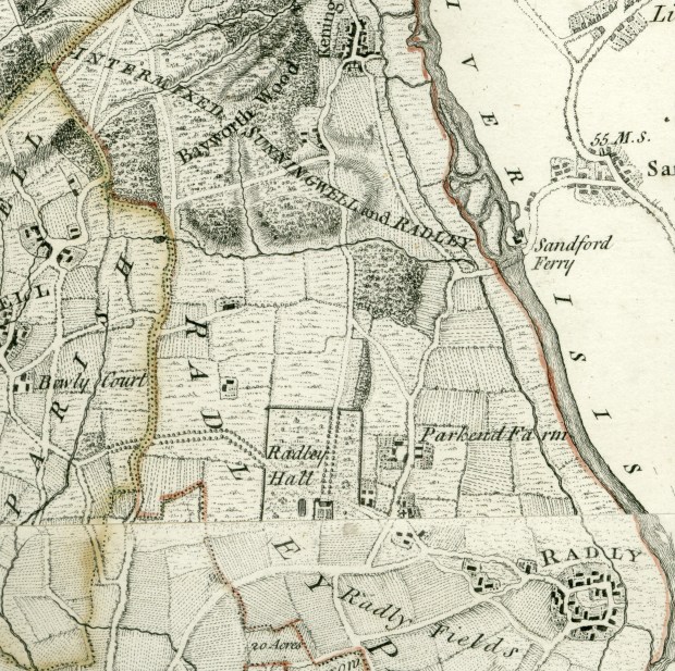
Improved roads and changes to land use and ownership gave rise to the need for accurate new maps. The Society of the Arts in London promoted the development and sale of accurate surveying equipment. The greatest achievement in mapping using their new equipment was Rocque’s Map of Berkshire, published in 1761. The map took ten years to complete, surveying the county at a scale of 1inch to 1 mile. A major aspect of it was the use of ichnographia – using different designs to accurately indicate land use. Another mapping innovation was to show all buildings in plan rather than in elevation. Rocque’s map shows the Park and new house at Radley Hall in detail. However, there are some issues with scale, particularly the relationship between house and pond.
Reading Rocque’s map
Rocque’s map shows the house standing on the southern edge of a rectangular enclosed Park which is apparently fenced with paling. To the south of the house, is a formal garden enclosed by a wall or ditch; south of that, fields down to the road now known as White’s Lane.
Running north across the Park from the north front, an avenue provided a formal approach, with another avenue from the west, roughly on the line that Cheesers follows today, with a pronounced ‘elbow’. This avenue crosses pasture. This provided another formal approach from (just beyond) the Oxford toll road. It stops as it reaches the Park boundary.
The drive that follows Cheesers is marked as angling towards the north front, passing it close, and continuing to a less formal entrance opposite Radley church. This less formal drive passes and may be intended to serve the offices which are shown immediately outside the rectangular Park on the east side.
To the west of the house (but oddly close) is an apparent oval water feature that may be a pond; it is shaded for water in the same way as the River Thames/Isis. No stream is marked
Outside the rectangular Park to the north is a narrow, linear Little Wood; otherwise, all the surrounding fields are indicated as pasture.
Rocque’s map shows just two avenues at Radley Hall. This supports the suggestion that the gardens were not completed in the 1720s. We do not know who designed the grounds. It is possible that it was the work of William Townesend and left incomplete when a legal dispute arose between himself and Sir John Stonhouse. Townesend certainly worked with Vanbrugh at Blenheim and possibly with Hawksmoor at nearby Shotover House. The incompleteness of the design is further highlighted by comparison with Marcham Place, just 6 miles away, and also shown on Rocque’s map. The house at Marcham was built in 1750, and despite the new designs being introduced by Capability Brown elsewhere in Oxfordshire and Berkshire, the grounds are shown in a much earlier 18th century style of multiple avenues. The western avenue at Radley, Cheesers, is a masterpiece of a long, processional route, curving around to bring the house slowly into view, whilst revealing magnificent views towards the borrowed landscape of the Berkshire Downs and the church spires of Abingdon. It reflects some of the best design of the earlier part of the century.
>more>>>Reconstructing Capability Brown’s work at Radley Hall: North & South views
>>>>more>>>Loss & Rediscovery: Capability Brown’s landscape at Radley
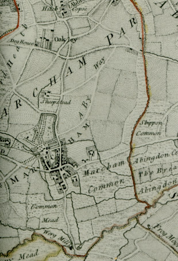
The house at Marcham Place (c. 6miles from Radley) was built in 1750. Rocque’s map shows an elaborate layout of avenues, typical of much earlier 18th century garden design. This supports the suggestion that the grounds at Radley were still incomplete in 1761
Clare Sargent
